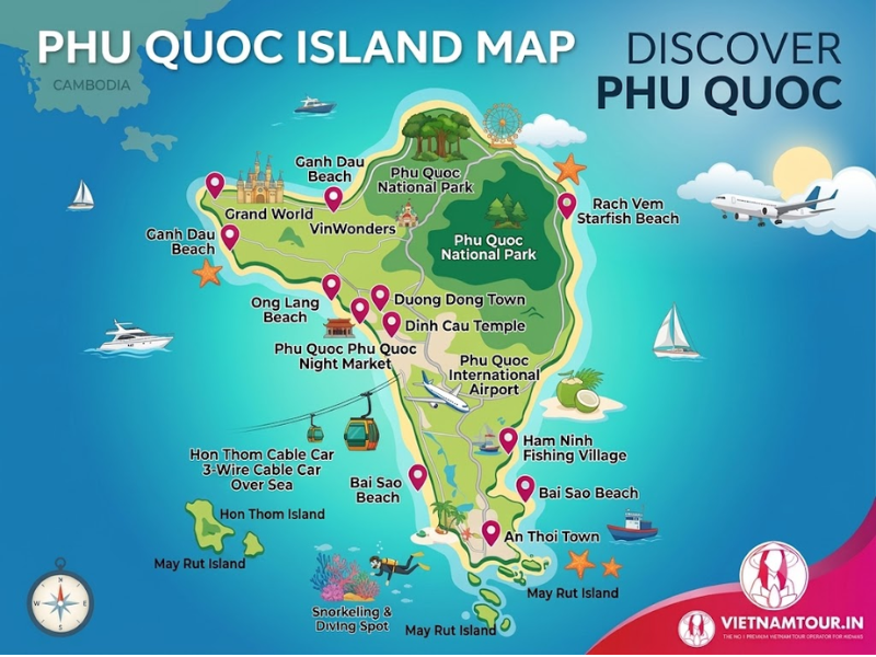
The Phu Quoc map shows Vietnam’s largest island in the Gulf of Thailand, about 300 km west-southwest of Ho Chi Minh City, in Phu Quoc Special Zone of An Giang Province. The island runs about 50 km from north to south, so it is easiest to read in 3 zones: the forested north with the theme parks, the central hub around Duong Dong, and the resort belt and cable car in the south. This guide to Phu Quoc Island includes custom maps for each zone, 12 pins to save before the trip and a Google My Maps version for offline use.
Phu Quoc tourist map 2026 showing the airport, Duong Dong, road DT45 and the north, central and south zones
Where Is Phu Quoc on the Vietnam Map?
On the Vietnam map, Phu Quoc sits at the country’s south-western edge in the Gulf of Thailand, about 300 km west-southwest of Ho Chi Minh City and about 15 km off the Cambodian coast.
| Fact | Detail |
|---|---|
| Location | Gulf of Thailand, south-western Vietnam |
| Administration | Phu Quoc Special Zone, An Giang Province (Kien Giang Province before 1 July 2025) |
| Size | About 575 km², about 50 km long and up to about 25 km wide in the north |
| Airport | Phu Quoc International Airport (PQC), about 10 km south of Duong Dong |
| From Ho Chi Minh City | About 300 km, around 1 hour by air |
| From Hanoi | About 1,240 km, around 2 hours 10 minutes by air |
Older maps and guidebooks still list the island under Kien Giang Province, which merged into An Giang in the 2025 reform, so both names refer to the same place. Most international trips connect through Ho Chi Minh City or Hanoi, and the routes from Ho Chi Minh to Phu Quoc and Hanoi to Phu Quoc compare flights and timings. The dry months from November to April suit all 3 zones, as the guide to the best time to visit Phu Quoc explains month by month.
Phu Quoc Tourist Map: How the Island Is Divided
The Phu Quoc tourist map splits the island into 3 zones: the forested north with the theme parks, the central Duong Dong hub, and the resort-heavy south around An Thoi. Road DT45, which becomes Tran Hung Dao Street through Duong Dong, runs the length of the island and links all 3 zones, and the airport is the easiest reference point for distances.
| Zone | From the airport | Main draw |
|---|---|---|
| Central: Duong Dong, Long Beach | About 10 km, 15–25 min | Town, night market, sunset beach |
| South: An Thoi, Sunset Town, Hon Thom cable car | About 18–22 km, 25–45 min | Beaches, cable car, resorts |
| North: Grand World, VinWonders, Vinpearl Safari | Up to about 35 km, 50–60 min | Theme parks, national park, quiet beaches |
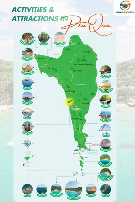
Map of Northern Phu Quoc
Northern Phu Quoc holds Phu Quoc National Park, Rach Vem fishing village, Ganh Dau Cape and the VinWonders, Vinpearl Safari and Grand World complex.
- VinWonders: about 30 km from Duong Dong; a full day for families, with rides and ticket details in the guide to VinWonders Phu Quoc.
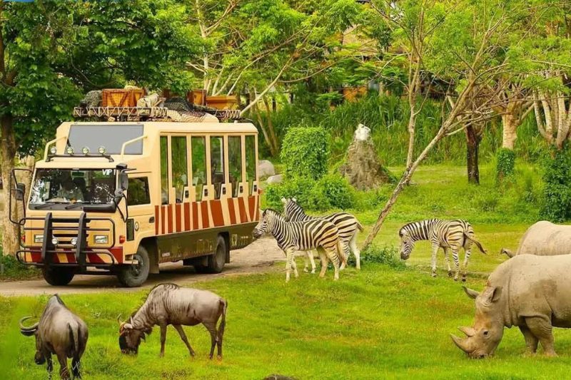
- Vinpearl Safari: about 30 km from Duong Dong; half a day for families.
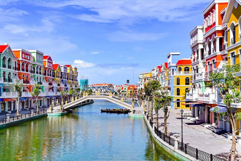
- Grand World and the Teddy Bear Museum: about 30 km from Duong Dong; evenings and rainy afternoons, with the Grand World Phu Quoc timings set out separately.
- Ganh Dau Cape: about 30–40 km from Duong Dong; sunsets and quiet coastline.
- Rach Vem and Starfish Beach: about 25–30 km from Duong Dong; shallow water and floating seafood shacks.
Phu Quoc National Park covers about half the island and spreads across the north and north-east, which is why the map shows it as a shaded area rather than a single pin.

Map of Central Phu Quoc: Duong Dong and Long Beach
Duong Dong is Phu Quoc’s town centre, where the night market, Dinh Cau Temple, Long Beach and most of the island’s restaurants sit within a few kilometres of each other.
- Dinh Cau Temple: on the rocks at the mouth of the Duong Dong River; sunset, 30 minutes.
- Phu Quoc Night Market: Bach Dang Street, a short walk from Dinh Cau; seafood dinners.
- Long Beach (Bai Truong): the coast south of town; sunsets and beach clubs.
- Duong Dong Market: the daytime local market; produce, dried seafood and fish sauce.
- Indian and vegetarian dining: clustered along Tran Hung Dao Street and the streets near the night market, with addresses in the guide to Indian restaurants in Phu Quoc.

Map of Southern Phu Quoc
Southern Phu Quoc is home to Sao Beach, Khem Beach, Phu Quoc Prison, Sunset Town and the Hon Thom cable car, with Ho Quoc Pagoda on the south-east coast.
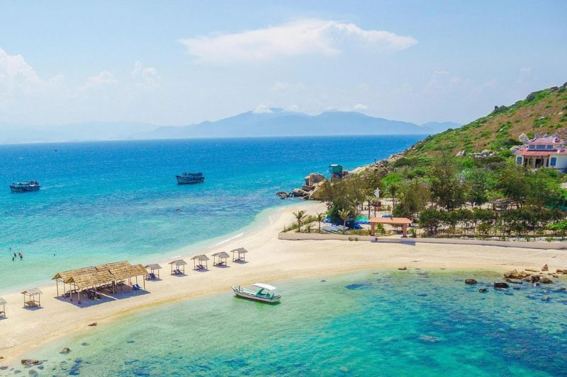
- Sao Beach: about 25–30 km from Duong Dong; white sand, 2–3 hours.
- Khem Beach: next to the An Thoi resort cluster; swimming and resort day passes.
- Ho Quoc Pagoda: about 25 km from Duong Dong; sea views, 1 hour.
- Phu Quoc Prison: about 28–30 km from Duong Dong; museum, 1 hour.
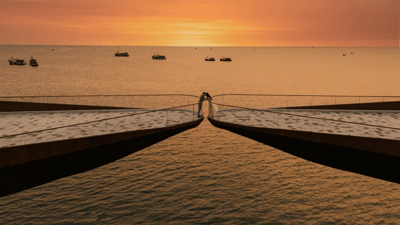
- Sunset Town and Kiss Bridge: at the southern tip; covered in the guides to Sunset Town Phu Quoc and the Kiss Bridge.
- Hon Thom cable car: from An Thoi; half a day with the water park.
The Hon Thom cable car holds the Guinness World Record for the longest non-stop three-rope cable car, at 7,899.9 m. The south sits 25–45 minutes from the airport, which makes it the easiest zone for travellers who land in the afternoon.
Phu Quoc Attractions Map: 12 Places to Pin Before You Go
These 12 pins on the Phu Quoc attractions map cover all 3 zones and fit into 3 sightseeing days: north, central and south. Pin numbers follow the route on the map, grouped by day rather than ranked.
| Pin | Place | Zone / day | From Duong Dong | Visit time |
|---|---|---|---|---|
| 1 | VinWonders | North, day 1 | About 30 km | Full day |
| 2 | Vinpearl Safari | North, day 1 | About 30 km | Half day |
| 3 | Grand World and Teddy Bear Museum | North, day 1 | About 30 km | Evening |
| 4 | Ganh Dau Cape | North, day 1 | About 30–40 km | 1 hr |
| 5 | Rach Vem and Starfish Beach | North, day 1 | About 25–30 km | 1–2 hr |
| 6 | Dinh Cau Temple | Central, day 2 | 0–1 km | 30 min |
| 7 | Phu Quoc Night Market | Central, day 2 | 0–1 km | Evening |
| 8 | Long Beach | Central, day 2 | 0–10 km | Sunset |
| 9 | Ho Quoc Pagoda | South-east, day 3 | About 25 km | 1 hr |
| 10 | Sao Beach | South, day 3 | About 25–30 km | 2–3 hr |
| 11 | Phu Quoc Prison | South, day 3 | About 28–30 km | 1 hr |
| 12 | Hon Thom cable car and Sunset Town | South, day 3 | About 25–30 km | Half day |
Approximate road distances from Duong Dong; visit times are indicative.
Opening hours, ticket prices and what to do at each stop are covered among the places to visit in Phu Quoc.
Where to Stay on the Phu Quoc Map
Duong Dong and Long Beach are the best areas for a first visit, because they sit closest to the airport, the night market and most restaurants, while the south suits honeymoons and the north suits theme-park families.
| Area | Best for | Why |
|---|---|---|
| Long Beach and Duong Dong | First visit, budget to mid-range | Walkable to the night market and Indian restaurants |
| Ong Lang | Couples | Quiet beach and boutique resorts |
| Khem Beach and the south | Honeymoons and luxury | Closest to the cable car and Sunset Town |
| North: Bai Dai and Ganh Dau | Families | Integrated resorts beside the theme parks |
How to Get Around Phu Quoc Using This Map
Grab, Xanh SM, taxis and private cars are the easiest ways to move between zones on the Phu Quoc map, while paid public bus routes link the airport, Duong Dong, An Thoi and the north.
| Trip | Distance and time | Approximate cost |
|---|---|---|
| Airport to Duong Dong | About 10 km, 15–25 min | Taxi about 180,000–220,000 VND (₹660–₹805) |
| Airport to the south (Sunset Town, cable car) | About 18–22 km, 25–45 min | Grab or taxi, fare shown in the app |
| Duong Dong to the north (Grand World) | About 30–35 km, 50–60 min | Grab car about 300,000–400,000 VND (₹1,100–₹1,465) |
| Public bus | Airport, Duong Dong, An Thoi and the north | About 20,000–40,000 VND (₹75–₹145) a ride |
Indicative 2026 fares; they change by season, so confirm with the app or driver.
Renting a scooter is not a legal option for most Indian passport holders, because Vietnam recognises International Driving Permits issued under the 1968 Vienna Convention, while India issues permits under the 1949 Geneva Convention. Riding without a recognised licence also voids most travel insurance, so a car with a driver is the practical choice for island loops.
A private car turns the 3 zones into 3 easy days, with the driver timing the north for the theme parks and the south for sunset. Share the travel dates in the form below, and a local expert at Vietnamtour.in will plan the island route with transfers and vegetarian or Jain meals arranged in advance.
Download the Phu Quoc Map (PDF and Google Maps)
The Phu Quoc map is available as a printable PDF and as a Google My Maps version with all 12 pins. The My Maps version opens on a phone and can be saved for offline use in the Google Maps app, which helps in the north of the island, where mobile coverage thins out.
Download the Phu Quoc tourist map (PDF)
FAQs About the Phu Quoc Map
How long does it take to drive from north to south Phu Quoc?
Driving from the northern theme parks to the southern cable car takes about 1 to 1.5 hours, because the island is about 50 km long and the main road runs through Duong Dong. Splitting the island into a north day and a south day avoids the full-length drive twice.
Which part of the Phu Quoc map is closest to the airport?
Duong Dong and Long Beach are closest, about 10 km and 15–25 minutes from the airport. The south is 25–45 minutes away and the northern theme parks 50–60 minutes, so first-time visitors usually stay in the centre.
Which part of Phu Quoc has the best beaches?
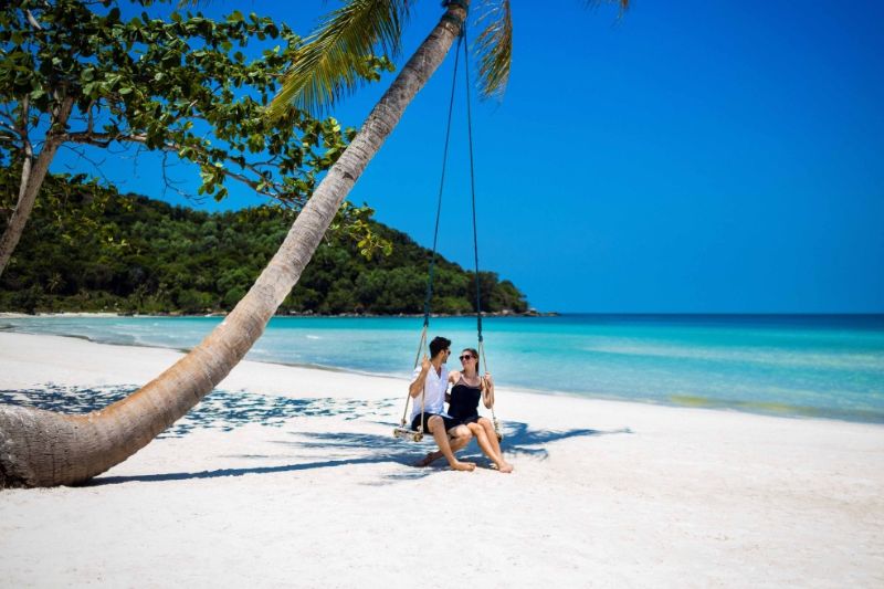
The south-east coast has the whitest sand, at Sao Beach and Khem Beach, while Long Beach on the west coast is best for sunsets. Starfish Beach in the north has the shallowest water, which suits families with small children.
Is Google Maps accurate for Phu Quoc?
Google Maps covers the main roads and attractions well, but newer venues can be missing or mislabelled after the island’s fast development. Checking a venue’s own page before setting out avoids a wasted drive, especially in the north.
Which province is Phu Quoc in on newer maps?
Newer maps place Phu Quoc in An Giang Province as Phu Quoc Special Zone, while maps printed before July 2025 show Kien Giang Province. Both names refer to the same island.
Plan a Phu Quoc Trip Around the Map
Phu Quoc reads as 3 zones on the map: theme parks and quiet beaches in the north, the town and sunset coast in the centre, and the cable car and white-sand beaches in the south, with Duong Dong or Long Beach the easiest base for a first visit. Vietnamtour.in has planned trips for more than 428,000 travellers since 2015, and every one of the Phu Quoc packages from India includes private transfers between the zones.