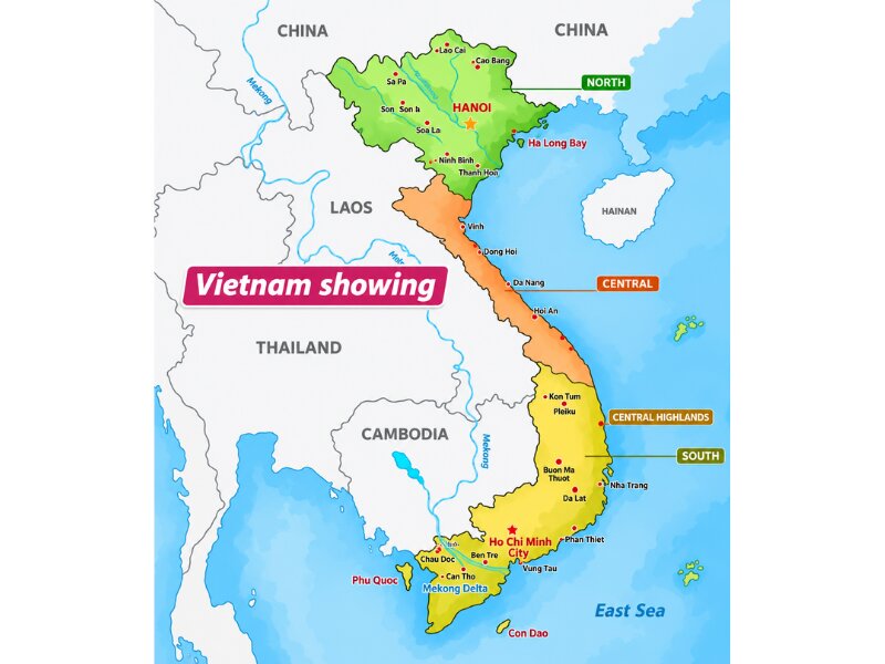
Vietnam sits in Southeast Asia on the eastern edge of the Indochinese Peninsula, between 8°02′ and 23°23′ North, with China to the north, Laos and Cambodia to the west and the East Sea along its 3,260 km coastline. On a world map, the country is an S-shaped strip 1,650 km long, about 3,000–3,700 km east of Delhi and Mumbai, or a 4.5–5.5 hour nonstop flight. This Vietnam in world map guide places the country on the globe, then zooms into the 3 regions, 12 destinations and the airports that Indian flights land at, so that readers can turn the map into a route.
Vietnam on the World Map: Key Facts
Vietnam is a country of 331,212 sq km, slightly larger than Maharashtra, running 1,650 km from north to south and only 50 km wide at its narrowest point in central Vietnam. The figures that place it on the map are set out below:
| Fact | Value |
|---|---|
| Continent / region | Asia / Southeast Asia |
| Coordinates | 8°02’–23°23′ N, 102°08’–109°28′ E |
| Area | 331,212 sq km (slightly larger than Maharashtra at 307,713 sq km) |
| Length north–south | 1,650 km |
| Width | 600 km in the north, 400 km in the south, 50 km at the narrowest (Quang Tri, formerly Quang Binh) |
| Coastline | 3,260 km on the East Sea, Gulf of Tonkin and Gulf of Thailand |
| Land neighbours | China (north), Laos and Cambodia (west) |
| Capital / largest city | Hanoi / Ho Chi Minh City (about 14 million) |
| Population | About 102 million (2025) |
| Administrative units | 34 provinces and cities (since 1 July 2025) |
| Time zone | UTC+7, 1 hour 30 minutes ahead of IST |
| Highest point | Fansipan, 3,143 m |
The S-shape comes from 2 wide deltas, the Red River in the north and the Mekong in the south, joined by a narrow mountainous centre, and about three-quarters of the land is hill or mountain. That shape is why most routes run along the coast rather than across it, with flights covering the long gaps between the deltas.
Vietnam Map by Region: North, Central and South
The Vietnam map divides into 3 regions that travellers treat as 3 separate trips: the North around Hanoi, the Centre around Da Nang and the South around Ho Chi Minh City, each with its own international airport and dry season.
Northern Vietnam: Hanoi Gateway
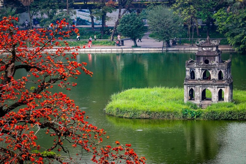
The North of Vietnam covers Hanoi, Ha Long Bay, Ninh Binh and Sapa, all within 6 hours of Noi Bai airport. The distances from the capital set the shape of a northern loop:
| Destination | From Hanoi (approx.) |
|---|---|
| Ha Long Bay | 170 km / 2.5 hours |
| Ninh Binh | 95 km / 2 hours |
| Sapa | 320 km / 5.5–6 hours |
The northern dry season runs from October to April, when Ha Long Bay is clear and Sapa’s terraces are harvested or green. Six hours is the longest transfer in the North.
Central Vietnam: Da Nang Gateway
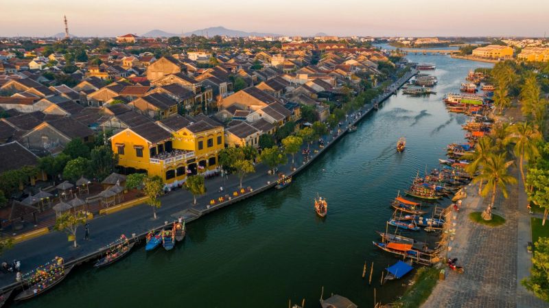
The Centre of Vietnam runs from Hue to Da Lat along the narrowest part of the map, with Da Nang airport in the middle. Distances here are short around Da Nang and long towards the south:
| Destination | From Da Nang (approx.) |
|---|---|
| Hue | 95 km / 2 hours |
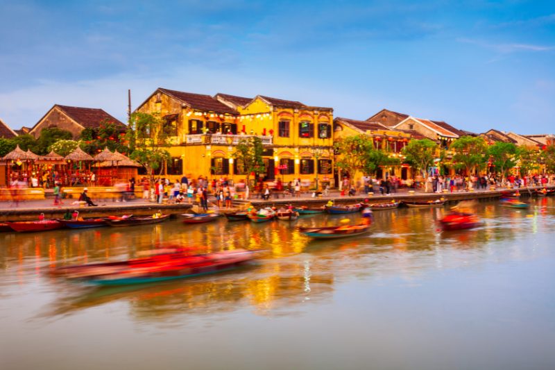
| Hoi An | 30 km / 45 minutes |
| Nha Trang | 530 km / 9 hours by train, or 1 hour by air from Ho Chi Minh City |
| Da Lat | 140 km from Nha Trang / 3 hours |
The central dry season runs from February to August, the opposite of the North’s. Da Nang airport sits 30 km from Hoi An and 95 km from Hue, so travellers can treat all 3 as 1 base with day trips.
Southern Vietnam: Ho Chi Minh City Gateway
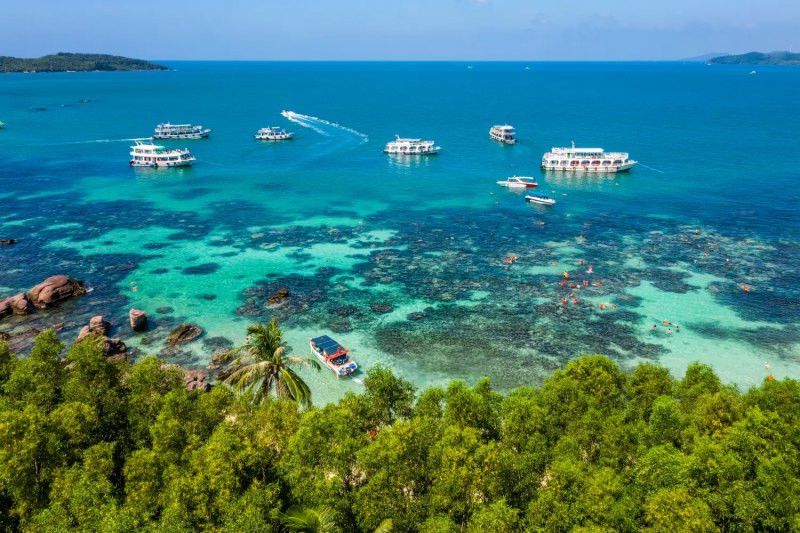
The South is flat delta country: Ho Chi Minh City, the Mekong Delta and Phu Quoc island off the south-west coast. Everything in the region starts from Tan Son Nhat airport:
| Destination | From Ho Chi Minh City (approx.) |
|---|---|
| Mekong Delta (My Tho) | 70 km / 1.5–2 hours |
| Can Tho | 170 km / 3 hours |
| Phu Quoc | 1 hour by air |
The southern dry season runs from November to April, with the hottest weeks in March and April.

Distance from India to Vietnam on the Map
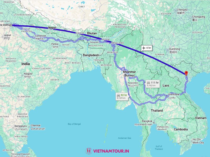
Vietnam lies 3,000–3,700 km east of India’s main airports, which put Hanoi about 4.5 hours and Ho Chi Minh City about 5.5 hours from Delhi by nonstop flight. On the map, Vietnam sits beyond Myanmar, Thailand and Laos, so the road route is not practical and every trip starts with a flight.
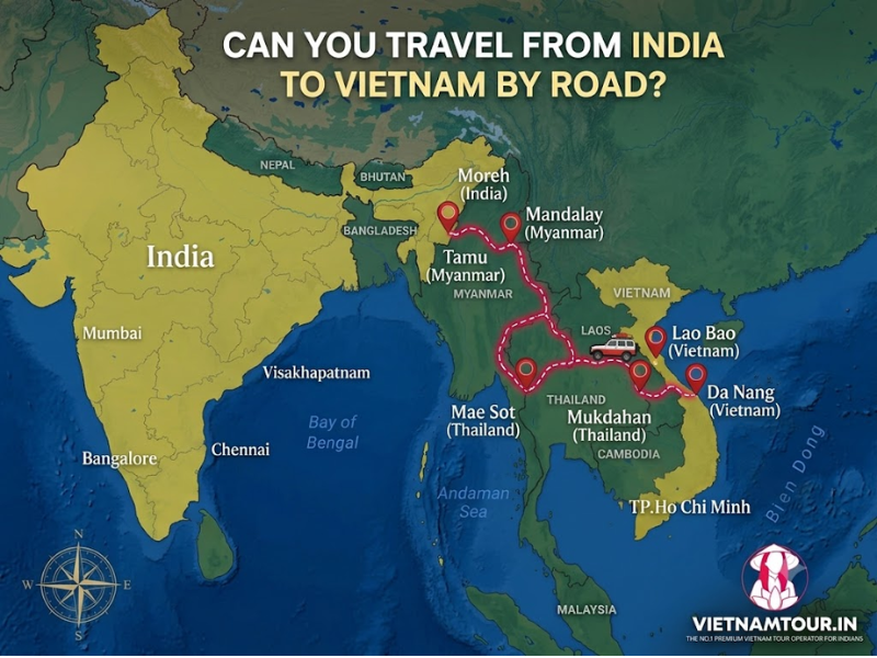
The routes below are the nonstop options as of October 2026:
| From | To | Distance (approx.) | Nonstop time | Operators (as of Oct 2026) |
|---|---|---|---|---|
| Delhi | Hanoi | 3,015 km | 4 h–4 h 35 min | Vietnam Airlines, Vietjet, IndiGo, Air India |
| Delhi | Ho Chi Minh City | 3,672 km | 4 h 45 min–5 h 30 min | Vietnam Airlines, Vietjet, Air India |
| Mumbai | Hanoi | 3,459 km | 4 h 15 min–5 h 05 min | Vietnam Airlines, Vietjet, Akasa Air, IndiGo |
| Mumbai | Ho Chi Minh City | 3,759 km | 4 h 55 min–5 h 30 min | Vietnam Airlines, Vietjet |
| Kolkata | Hanoi | 1,805 km | 2 h 40 min–3 h 05 min | IndiGo |
| Bengaluru | Hanoi | 3,125 km | 4 h 35 min–4 h 45 min | Vietnam Airlines |
| Bengaluru | Ho Chi Minh City | 3,175 km | About 4 h 55 min | Vietjet |
| Hyderabad | Hanoi | 2,922 km | 4 h 05 min–4 h 25 min | Vietnam Airlines |
| Hyderabad | Ho Chi Minh City | 3,144 km | 4 h 25 min–4 h 30 min | Vietjet |
| Ahmedabad | Hanoi | 3,434 km | 4 h 15 min–4 h 40 min | Vietjet; Vietnam Airlines from 3 Nov 2026 |
| Ahmedabad | Da Nang | About 3,800 km | About 5 h 25 min | Vietjet, seasonal (winter schedule, 2–3 weekly in past seasons) |
| Ahmedabad | Phu Quoc | — | About 5 h 25 min | Sun PhuQuoc Airways from early December 2026 |
Vietnam runs 1 hour 30 minutes ahead of India, so a flight of 4.5 hours shows as 6 hours on the clock. Chennai, Kochi and other Indian cities have no nonstop service, so those trips connect through Delhi, Mumbai, Bengaluru or a Southeast Asian hub. Da Nang has 1 seasonal nonstop, Vietjet’s Ahmedabad–Da Nang service, which runs 2–3 times a week mainly on the winter schedule from late October to May; outside that window, and from other Indian cities, Da Nang is reached with 1 stop in Hanoi or Ho Chi Minh City.
The full India to Vietnam distance, city by city, is set out in the guide to the India to Vietnam distance, and which gateway each Indian city serves is tracked route by route in the guide on how to go to Vietnam from India.
International Airports on the Vietnam Map
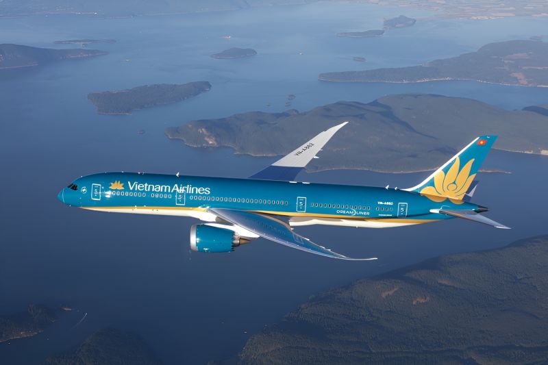
4 airports on the Vietnam map serve as gateways for Indian travellers: Noi Bai (Hanoi) in the north, Tan Son Nhat (Ho Chi Minh City) in the south, Phu Quoc with its first nonstop from India from December 2026, and Da Nang in the centre, served nonstop from Ahmedabad on a seasonal basis and by 1-stop connections the rest of the year. 2 more airports handle the domestic hops that most routes need:
| Airport | Code | City | Distance to city centre | Serves |
|---|---|---|---|---|
| Noi Bai International | HAN | Hanoi | 27 km / 40–60 min | North; nonstop from India |
| Tan Son Nhat International | SGN | Ho Chi Minh City | 8 km / 30–45 min | South; nonstop from India |
| Da Nang International | DAD | Da Nang | 3 km / 10–15 min | Centre; seasonal nonstop from Ahmedabad (Vietjet, winter schedule), otherwise 1 stop via Hanoi or Ho Chi Minh City |
| Phu Quoc International | PQC | Phu Quoc | 10 km / 20 min | Phu Quoc island; nonstop from Ahmedabad from early December 2026 |
| Cam Ranh International | CXR | Nha Trang | 35 km / 45 min | Domestic from HAN / SGN |
| Lien Khuong | DLI | Da Lat | 30 km / 40 min | Domestic from HAN / SGN |
Domestic flights stitch the regions together: Hanoi–Ho Chi Minh City takes about 2 hours 10 minutes, Hanoi–Da Nang and Ho Chi Minh City–Da Nang about 1 hour 20 minutes each, and Ho Chi Minh City to Phu Quoc, Cam Ranh or Da Lat about 50 minutes to 1 hour. The island’s own airport, beaches and towns are laid out on the Phu Quoc map.
All 4 gateways require the e-visa and the Digital Arrival Card before landing, and the Vietnam visa guide for Indians lists the fee and the online steps.
Reading the Vietnam Travel Map for a 7, 10 or 14-Day Route
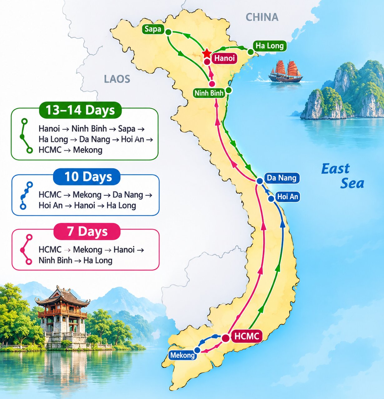
The Vietnam travel map works best read in 1 direction, north to south or south to north, with 1-hour domestic flights replacing the 1,726 km Reunification Express between regions. The 3 most common lines on the map are:
- 7 days, 2 regions: The shortest line pairs the South and the North with 1 domestic flight: Ho Chi Minh City and the Mekong first, then Hanoi, Ninh Binh and a night on Ha Long Bay. The 7-day line on the map is the route of Vietnam for Family Bonding: From Ho Chi Minh City, Mekong to Hanoi, Ninh Binh, and Halong.
- 10 days, 3 regions: 3 extra days buy the Centre: Da Nang and Hoi An sit between the Mekong and Hanoi, with 2 short flights instead of 1. The 10-day line adds the centre, as in Holiday with Coastal Charm and Cultural Highlights from Saigon to Halong Bay.
- 13–14 days, the full length: 2 weeks allow Sapa in the mountains before the bay, then the coast, then the delta, so the line runs the full 1,650 km of the map. The 14-day line reaches Sapa before the coast, following Vietnam Beachside Journey from Halong Bay to Da Nang in 13 Days.
Each region has its own planning guide: the complete Hanoi travel guide sets out which of the 4 northern stops to pair on a 4-day loop, the Da Nang travel guide treats Da Nang, Hoi An and Hue as 1 base, and the Ho Chi Minh City travel guide starts with where to stay before heading into the delta.
Each of the 12 markers on the map has a short profile, best months and days needed in the guide to Vietnam famous places, while the main urban stops are compared in the guide to the cities of Vietnam. Any of the 3 lines can be redrawn around Hue, Nha Trang or Da Lat using the full list of Vietnam tours by Vietnamtour.in, which groups routes by length and region, and travellers who want only the island can start from a Phu Quoc package.
Frequently Asked Questions About Vietnam on the World Map
Indian travellers looking at Vietnam on the world map most often ask where it is, its neighbours, its income level, why it is famous, its size and its time zone.
Where is Vietnam located in the world?
Vietnam is in Southeast Asia, on the eastern side of the Indochinese Peninsula, facing the East Sea and the Pacific Ocean. It lies 3,000–3,700 km east of India, across the Bay of Bengal.
Which country is near Vietnam?
China, Laos and Cambodia share land borders with Vietnam, and Thailand, Malaysia, the Philippines and Indonesia lie across the sea. Bangkok is about 1 hour 40 minutes by air from Hanoi, and Singapore about 2 hours from Ho Chi Minh City.
Is Vietnam a rich or poor country?
Vietnam became an upper-middle-income economy in the World Bank’s July 2026 classification, with GNI per capita of US$4,970 in 2025. Hotels, food and transport still cost less than in many Indian cities, and income figures say little about holiday prices, which the Vietnam trip cost from India breaks down by hotel tier and meal.
Why is Vietnam so famous?
Vietnam is known for Ha Long Bay, Hoi An and 7 other UNESCO World Heritage Sites (9 in total as of 2026), for street food such as phở and bánh mì, and for the 1955–1975 war that shaped the modern country. Indian travellers know it mainly for low costs, an online e-visa and nonstop flights of about 4.5 hours, and the full story is in the guide to why Vietnam is famous.
Is Vietnam bigger than India?
No, Vietnam is about one-tenth the size of India by area, at 331,212 sq km against 3,287,263 sq km, and roughly equal to Maharashtra. Its population of about 102 million is close to one-fourteenth of India’s.
Is Vietnam in the same time zone as India?
No, Vietnam is 1 hour 30 minutes ahead of India (UTC+7 against IST UTC+5:30), so a 9:00 AM departure from Delhi lands in Hanoi at about 3:00 PM local time. Vietnam does not change its clocks for summer.
Turning the Vietnam Map into a Trip Plan
Read from north to south, the Vietnam map turns into a decision in 3 steps: pick the region whose dry season matches the travel dates, pick the gateway airport that the home city flies to, and let the domestic flights draw the line between them. The part that takes work is the order of the flights and nights, from which airport to land at to which 1-hour hop joins the regions without losing a day.
Vietnamtour.in, part of Seni World Travel, has arranged that for more than 428,000 travellers from India since 2015, with local experts in Vietnam and a team in Delhi. Dates and a preferred region sent through the form to get a quote for a custom Vietnam route come back as a route drawn on this map within 24 hours, or on WhatsApp.
- Hanoi HQ: Floor 4, Bao Anh Building, 62 Tran Thai Tong, Cau Giay, Hanoi
- Delhi: A 10/1 Gujrawala Town Part 1, Main G T Karnal Road, Delhi 110009
- India hotline: +91 88502 95722
- Vietnam / WhatsApp: +84 948 333 087
- Email: [email protected]
Share the travel dates, departure city and preferred region in the form below to get a route drawn on the Vietnam map.